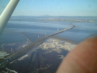
We started at the Palo Alto airport. Shortly after takeoff, we flew over the bridge on Highway 94? (Pardon the finger... :):
As we kept cruising at 1,300 to 1,400 feet, I looked down and saw another plane quite a bit below us:
Once I looked forward, I discovered he was on final for the San Carlos airport:
A few minutes after that, I was surprised to find that we were allowed to fly right over San Francisco International airport:
Once past the airport, we turned North towards the city:
On the way, we past 3Com Park:
Continuing North, we got closer to the city:
And eventually came to the Bay Bridge with Treasure Island in the middle:
Which means that we were finally quite close to the city:
We then flew West and circled Alcatraz:
And headed on to The Golden Gate Bridge:
Between the third and fourth pictures there, we circled North over Sausalito, but none of those pictures came out well. Once we turned South, we got another good picture of the city from the North:
Then we turned South and headed along the coast. Along the way, we flew over a cliff with Highway 1 running along the edge,:
a nice looking beach,:
and a golf course:
Once we hit Half Moon Bay, we turned East and flew over the Stanford Linear Accelerator:
and eventually came back to PAO again:
On the downwind leg, we were headed straight at Moffett Federal Airfield. (Here I really wished I had a working zoom):
And after 1.0 hours, we pulled back into our parking space after an excellent tour. (Thank you again, Amos!!)
Last modified March 27, 2002.
Send us comments to:
Brian Gunn